Varovanje kraških voda. Obširen slovenski pristop h kartiranju ranljivosti in tveganja za onesnaženje.
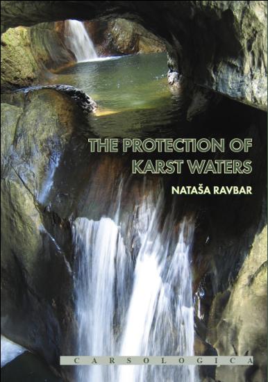
The Protection of Karst Waters. A comprehensive Slovene approach to vulnerability and contamination risk mapping.


Author: Nataša Ravbar
Year: 2007


Drinking water is a vital need but nevertheless it is not available to everybody neither by quantity nor quality. Karst aquifers hold important water resources, but are also very sensitive against the pollution. Therefore the passive and active protection is increasingly important, among these the education of inhabitants as well as new and better technical solutions have to be evolved.
The work of Nataša Ravbar is important from both points of view. Results of the inquiry related to the attitude of the local people towards water show its stage in the karst regions of Slovenia. On the other side the concept of groundwater vulnerability is increasingly used for karst water protection worldwide. Based upon a detailed review of different methods used or even obligatory in Europe, the author proposes a new methodology of groundwater vulnerability and risk mapping for the protection of karst sources – the Slovene Approach.

The Approach has been successfully applied and verified in the catchment of the karst spring Podstenjšek at the foot of the Snežnik mountain (Southern Slovenia). A wide range of different geomorphological and hydrological methods and techniques, including monitoring of the karst spring, hydrochemical analyses, tracing of underground water and geophysical survey have been applied. Hence, a better understanding of the regional hydrogeology has been achieved.
The monograph is useful for practitioners and decision-makers dealing with the protection and management of karst groundwater resources, and for scientists doing research on karst hydrogeology and vulnerability mapping. It is a valuable source of information and inspiration for further works dealing with karst groundwater protection in Slovenia and elsewhere.


Table of content

1 INTRODUCTION

1 The background

2 Goals and objectives

I – METHODOLOGY

2 KARST AQUIFER SYSTEMS

1 General properties and vulnerability of karst aquifers

2 Karst in Slovenia with special regard to hydrological systems

1 Alpine karst

2 Dinaric karst

3 Isolated karst

3 Human impact on karst water source quality – examples from Slovenia

3 KARST WATER SOURCES IN SLOVENIA

1 Importance of karst water sources

2 Contemporary drinking water consumption - in southwestern Slovenia

1 Introductory remarks

2 Attitude towards drinking water

3 Water source management and its quality

3 Conclusions

4 PROTECTION OF WATER SOURCES

1 Preliminary note

2 Slovene legislation on water source protection

3 The legislative response to the karst environment

4 Vulnerability and risk mapping as an alternative

5 VULNERABILITY ASSESSMENT AND MAPPING

1 Terminology

2 The concept of vulnerability

3 Overview of some basic methods

1 The EPIK method

2 The PI method

3 The SINTACS method

4 The Irish method

5 The European Approach

6 The COP method

7 The Simplified method

6 VULNERABILITY MAPPING IN SLOVENE KARST REGIONS

1 Previous experience

2 General methodological problems related to vulnerability assessment

3 A new method proposal?

7 THE SLOVENE APPROACH TO INTRINSIC VULNERABILITY MAPPING

1 Introductory remarks

2 Overlying layers (O factor)

1 Soil sub-factor classification

2 Evaluation of the extremely karstified areas protective function

3 Infiltration conditions (C factor)

1 Integrating hydrological variability

2 Integrating surface waters

3 Evaluation of the slope inclination and vegetation cover protection values

4 Assessment of the C factor

4 Precipitation regime (P factor)

5 Karst network development (K factor)

6 Source protection zones determination

8 THE SLOVENE APPROACH TO HAZARD AND RISK MAPPING

1 Introductory remarks

2 Basic concepts

3 Hazard assessment

1 Hazard weighting

2 Hazard ranking

3 Likelihood of a contaminant release

4 Production of hazard maps

4 Importance of water resource or source

5 Risk assessment

1 Risk intensity

2Total risk assessment

II – APPLICATION

9 HYDROGEOLOGICAL CHARACTERISATION OF THE STUDIED AREA

1 The Podstenjšek karst springs

2 Overview of previous research

3 Geological and hydrological settings

4 Climate conditions

5 Soil and vegetation cover

6 Hydrological characteristics of the Podstenjšek springs

7 Outlining the recharge area of the springs

1 Water balance and hydrograph analyses

2 Hydrochemical and microbiological properties

3 Tracer test findings

4 Delineation of the catchment area

8 Characteristics of the catchment area

1 Detailed structural-lithological and geomorphological mapping

2 Soil and sediment depth measurements

10 APPLICATION OF DIFFERENT VULNERABILITY METHODS

1 Overview

2 Application of the EPIK method and results

3 Application of the PI method and results

4 Application of the COP method and results

5 Application of the Simplified method and results

6 Application of the Slovene Approach and results

7 Comparison of the maps and discussion

11 HAZARD AND RISK ASSESSMENT

1 Importance of the Podstenjšek springs for drinking water supply

2 Actual and potential sources of contamination

1 The Šembije village

2 Agricultural activities

3 Traffic

4 Waste material disposal and excavation sites

3 Mapping of hazards

4 Risk mapping

5 Necessary measures for the springs protection

6 Future planning predictions

12 VALIDATION OF THE RESULTING MAPS

1 Reliability of the maps and validation mode

2 Validation of the obtained maps with tracer tests

1 Injection sites infiltration conditions

2 Injection mode

3 Sampling and analysing

3 Results

4 Concluding comment

13 GENERAL CONCLUSIONS AND OUTLOOK

1 Significance of the results

2 Applicability of the Slovene Approach

3 Mapping scale

4 New research challenges

1 Dependence of karst aquifer’s vulnerability on the hydrological conditions

2 A holistic validation technique development

3 Integrating exploitation issues

14 VAROVANJE KRAŠKIH VODA – OBŠIREN SLOVENSKI PRISTOP H

KARTIRANJU RANLJIVOSTI IN TVEGANJA ZA ONESNAŽENJE (POVZETEK)

1 Predstavitev problematike

2 Namen in praktična vrednost raziskave

3 Izhodišče za razvoj Slovenskega pristopa

4 Ocenjevanje naravne ranljivosti

1Vrednotenje zaščitne funkcije

2Vključitev hidrološke spremenljivosti ter zaščita površinskih voda

3Vrednotenje nagnjenosti površja in vegetacijskega pokrova

4Padavinski režim

5 Ocenjevanje ranljivosti vodnih virov

1 Razvoj kraškega sistema (K faktor)

2 Določevanje vodovarstvenih območij

6 Analiza tveganja

1 Ocenjevanje dejanskih in potencialnih obremenjevalcev

2 Pomembnost podzemne vode ali vodnega vira

3 Ocenjevanje tveganja za onesnaženje vodnega telesa

7 Aplikacija na primeru izvirov Podstenjška

1Naravne značilnosti zaledja

2Fizikalno-kemične značilnosti izvirov

3Antropogene dejavnosti v zaledju

4Karte naravne ranljivosti zaledja in tveganje za vodne vire

8 Veljavnost kart

9 Nujni ukrepi za zavarovanje in nasveti za prihodnje načrtovanje

10 Sklepi in izzivi za raziskovanje

15 REFERENCES

1 Literature

2 Other data sources


price


Keywords
aquifers
Karst
karst hydrology
protection of waters
water resources


Options

Add to favorites

Print

Send by e-mail

QR